Tip:
hold "shift" and click on link to open in new window
Around Swindon
Art
Business Index
Churches Index
Eat/Drink/Sleep
General Swindon Index
Old Town
Railway Village
Schools/Colleges
Streets & Roads
Town Centre
War Memorials
West Swindon
Search surnames for
Swindon
or
all
locations
General Swindon Index
Church Place, Swindon, Wiltshire
Church place is in the Railway Village area of Swindon. It is an 'L' shape, running along two edges of Faringdon Road Park, from Park Lane to Faringdon Road.
Church Place
|
Map
|
Taken from Faringdon Road Park, Church Place is the other side of the red brick wall
More photographs on the park
View Image
|
Download
Photo No: 01571 Size: 1137k
Photo Date: May 2012
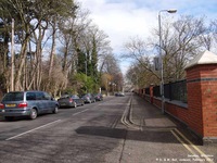
Church Place, taken near junction with Rodbourne Road
View Image
|
Download
Photo No: 01338 Size: 1505k
Photo Date: February 2012
St. Mark the Evangalist Church
More photographs
View Image
|
Download
Photo No: 00282 Size: 226k
Photo Date: January 2001
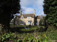
Former Rectory of St. Mark's Church in Church Place.
Now a nursery
More photographs
View Image
|
Download
Photo No: 01340 Size: 1946k
Photo Date: February 2012
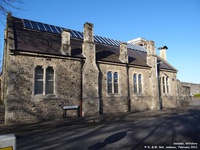
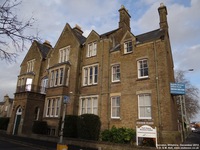
The former Great Western Railway School on the corner of Church Place and Bristol Street
More photographs
View Image
|
Download
Photo No: 01056 Size: 1546k
Photo Date: February 2012
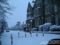
A snowy Church Place taken from Faringdon Road
View Image
|
Download
Photo No: 06440 Size: 685k
Photo Date: January 2010
Park House
Church Place
More photographs
Website
|
Map
View Image
|
Download
Photo No: 02993 Size: 1741k
Photo Date: December 2013
Top
General Swindon Index
Location Index
Search surnames for
Swindon
or
all
locations
HOME
|
Contact Us
|
Copyright
|
Donate
|
FAQs
|
Links
|
Location Index
|
Sponsors
|
Surname Search
|
Us
|
War Memorials
|
Wiltshire Collections
Tip:
hold "shift" and click on link to open in new window
This page was last updated on 31/08/2022 23:09:26
© Copyright D & M Ball 1999-2022
oodwooc mē fēcit